Geography
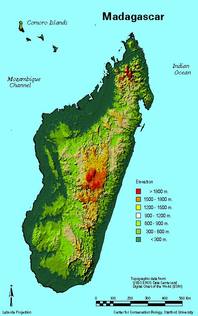
Madagascar is a the 4th largest island measuring about 587,040 square kilometers off the east coast of Africa. This natural island has a variety of biomes. Rainforests and lowlands are found in the east, dry, deciduous forests and protected harbors in the west, while the south has plateaus and a desert region. The Tsaratanana Massiv region is found in the north of Madagascar, which includes the highest point of the island of 2,880 meters and the Montagne d'Ambre or Ambohitra, which is of volcanic origin. This area has been protected since the French rule, and later became a reserve in 1966.
Climate
With this array of topography, Madagascar has a varying climate throughout the country. However, generally there are two main seasons, a hot, rainy season from November to April and a cooler, dry season from May to October. The east coast gets the most rain, which explains the existence of rainforests there. The west coast has the deciduous forests, where trees will lose their leaves during the dry season and flourish again during the wet season. The south of the island has a much drier climate, and some parts in the southeast can even be classified as a desert as little to no rain falls here.
Biodiversity
The diverse array of habitats in Madagascar allows for the survival of thousands of unique species. Madagascar is a biodiversity hotspot with about 5% of the world’s plant and animal species and 80% of these endemic to Madagascar. In the last several years, 600 new species have been discovered, which according to the World Wildlife Foundation includes 385 plants, 42 invertebrates, 17 fish, 69 amphibians, 61 reptiles and 41 mammals. Madagascar’s isolation plays a large role in its ability to support all these species. Madagascar split from the African continent millions of year ago, and has continued as a place of isolated species evolution.
Natural Resources
Natural resources found in Madagascar include graphite, coal, rare earth elements, salt, quartz, tar sands, fish and hydropower.
